
Knockastanna [Cnoc an Stanna]
Good walks are even better shared.
Overview
Knockastanna [Cnoc an Stanna]
Knockastanna, a charming hill nestled in the beautiful Munster region of Ireland, is a delightful spot for both seasoned hikers and those looking to dabble their toes in the outdoor experience. At an elevation of 550 meters, it may not be the tallest in the area, but what it lacks in height, it makes up for with stunning panoramic views and intriguing terrain.
Geology
The fascinating geology of Knockastanna is primarily dominated by granite and limestone, which have weathered beautifully over time. Expect a rocky path to the summit, interspersed with lush grassy sections. Ancient glacial activity is evident, showcasing the history of this rugged landscape.
Access
Parking
Parking is available at Upper Lough Lee, where you can leave your vehicle without hassle. Just don’t forget where you parked; it can feel like a game of hide-and-seek after a long hike!
Public Transport
Public transport options are limited in rural parts of Munster. It’s advisable to drive or arrange for taxis from nearby towns.
Nearest Town
Sneem is the closest town, located about 12 km away, and is a lovely little hub with all the friendly locals you’d expect from a quaint Irish village.
Routes
Numerous routes lead to the summit of Knockastanna:
Upper Lough Lee Route: A 6.5 km trek through woodlands offers a moderate challenge, perfect for families. Expect the occassional wildlife sighting alongside your adventure.
Ballaghbeama Gap Route: For those seeking a bit more of a workout, this challenging 8 km route provides spectacular views as you ascend.
Summit Features
At the summit, you will find a cairn as a nod to adventurers who have come before you. The gorgeous vistas span the horizon, truly showcasing the beauty of Ireland’s landscape.
Views
On a clear day, the summit rewards you with incredible views of the Slieve Mish Mountains and the enchanting Atlantic, making every arduous step worthwhile. The late spring and early autumn are prime times for catching sight of these stunning views.
Hazards
Be cautious, as the rocky terrain may pose risks of slips; sturdy shoes are a must. Additionally, the weather can turn as quick as a magician's trick, so keep an eye on those clouds!
Nearby Summits
Consider tackling nearby peaks like Caherbanna Mountain and Cnoc na Móinteach for a full day of adventure.
Facilities
When you’ve returned from your hike, seek out one of the charming local cafes in Sneem for a well-deserved scone or some traditional Irish stew. Public toilets are easily accessible in town for your convenience.
History
Knockastanna means 'Hill of the Stanna', steeped in Irish folklore and local traditions; it's a reminder of the cultural richness that fills this land.
So grab your boots, pick a route, and immerse yourself in the breathtaking beauty of Knockastanna. Happy hiking!
Explore routes near Knockastanna [Cnoc an Stanna]
Public walks starting within 80 km of this hill. Nearby does not mean a route reaches the summit; check its map and access before setting out.
No public routes are currently listed within 80 km of Knockastanna [Cnoc an Stanna] on Walkmates. This does not mean there are no paths here. Explore the map and check local access information before planning a walk.
Route planning notes
These notes describe possible approaches, not verified navigable routes or permission to cross land. Check current paths, local access rules and conditions before setting out.
Upper Lough Lee Route
This route begins at Upper Lough Lee and leads you through lush woodlands before ascending to the summit. It offers a blend of scenic views and intriguing wildlife spotting.
Ballaghbeama Gap Route
Starting from Ballaghbeama Gap, this route provides a steady climb with breathtaking views over the surrounding valleys.
Make a day of it, together
Find someone to share the walk with, or organise a day out along a route you like.
Hill facts and local notes
Classifications
Elevation
444m
1,457 ft
Prominence
190m
Coordinates
52.6554, -8.2032
R863560
OS Map
66
At the Summit
At the summit, you will find a cairn that has seen more selfies than an Instagram influencer. The views are expansive, encompassing the rolling hills and expansive valleys of County Kerry.
Terrain & Geology
The hill is primarily composed of granite and limestone, which gives it a unique rugged charm that can be both beautiful and challenging to traverse. The presence of ancient glacial activity can be seen in its scoured slopes and distinctive features.
Views & Scenery
On a clear day, your eyes will feast on the majestic Slieve Mish Mountains to the west and the pristine stretch of the Atlantic Ocean to the south.
History & Heritage
Name Origin
The name 'Knockastanna' translates to 'Hill of the Stanna', with 'Cnoc' meaning 'hill' in Irish.
Historical Significance
This area is rich in folklore and has been a site of historical significance, particularly in the context of local Gaelic traditions.
Getting There & Facilities
Check current local access restrictions, parking rules and transport timetables before travelling. These notes do not confirm public access to the summit.
Parking
There is ample parking available at Upper Lough Lee, where you can safely leave your vehicle before embarking on your hike.
Public Transport
Public transport is limited; it’s advisable to travel by car. However, nearby towns may offer local taxis.
Nearby Facilities
There are some lovely local cafes in Sneem where you can refuel with a warm scone and a cup of tea before or after your hike. Public toilets are also available in town.
Safety Information
Known Hazards
- Rocky terrain may pose a risk of slips. Be cautious of sudden changes in weather, typical of the Irish landscape.
General Safety Tips
- Check weather conditions before setting out
- Carry appropriate clothing and equipment
- Let someone know your planned route
- Take a map, compass, and GPS device
- Carry emergency supplies: food, water, first aid kit, torch
Hills
Some common questions about the hills answered
Are there group walks up Knockastanna [Cnoc an Stanna]?
Many walkers use Walkmates to join or organise walks with others. You can check for group walks around Knockastanna [Cnoc an Stanna] through the maps
Are there other walkers around Knockastanna [Cnoc an Stanna]?
Activity varies by location and time, but Walkmates lets you see whether others have shared walks or shown interest in this area. Find other people through the walking friends search walking friends for Knockastanna [Cnoc an Stanna] search or of course create your own walk for Knockastanna [Cnoc an Stanna]
Can I organise a walk to Knockastanna [Cnoc an Stanna]?
Yes. If there aren’t any walks listed already, you can create a walk and make it available for others to join.
If you're signed up to Walkmates, you can create a walk to Knockastanna [Cnoc an Stanna].
How do I find a walk up this hill?
There are often multiple ways to walk this hill, depending on experience and route preference. Walkmates helps you explore walks and routes that others have shared.
Can I suggest a new route up Knockastanna [Cnoc an Stanna]?
Yes. You can suggest or create routes to share with others. Walkmates focuses on the social side of walking, so routes are used to help people organise walks and explore areas together, rather than as detailed navigation tools or route libraries.
Other uses really appreciate knowledgeable walkers sharing their routes. Share your favourite route to Knockastanna [Cnoc an Stanna] here
The is an error or something incorrect about this hill. How do I let you know?
We always strive to keep the information on Walkmates as accurate as possible. If you find an error, please let us know through the contact form and we'll aim to correct it as quickly as possible
Community Discussion
Comments
Location
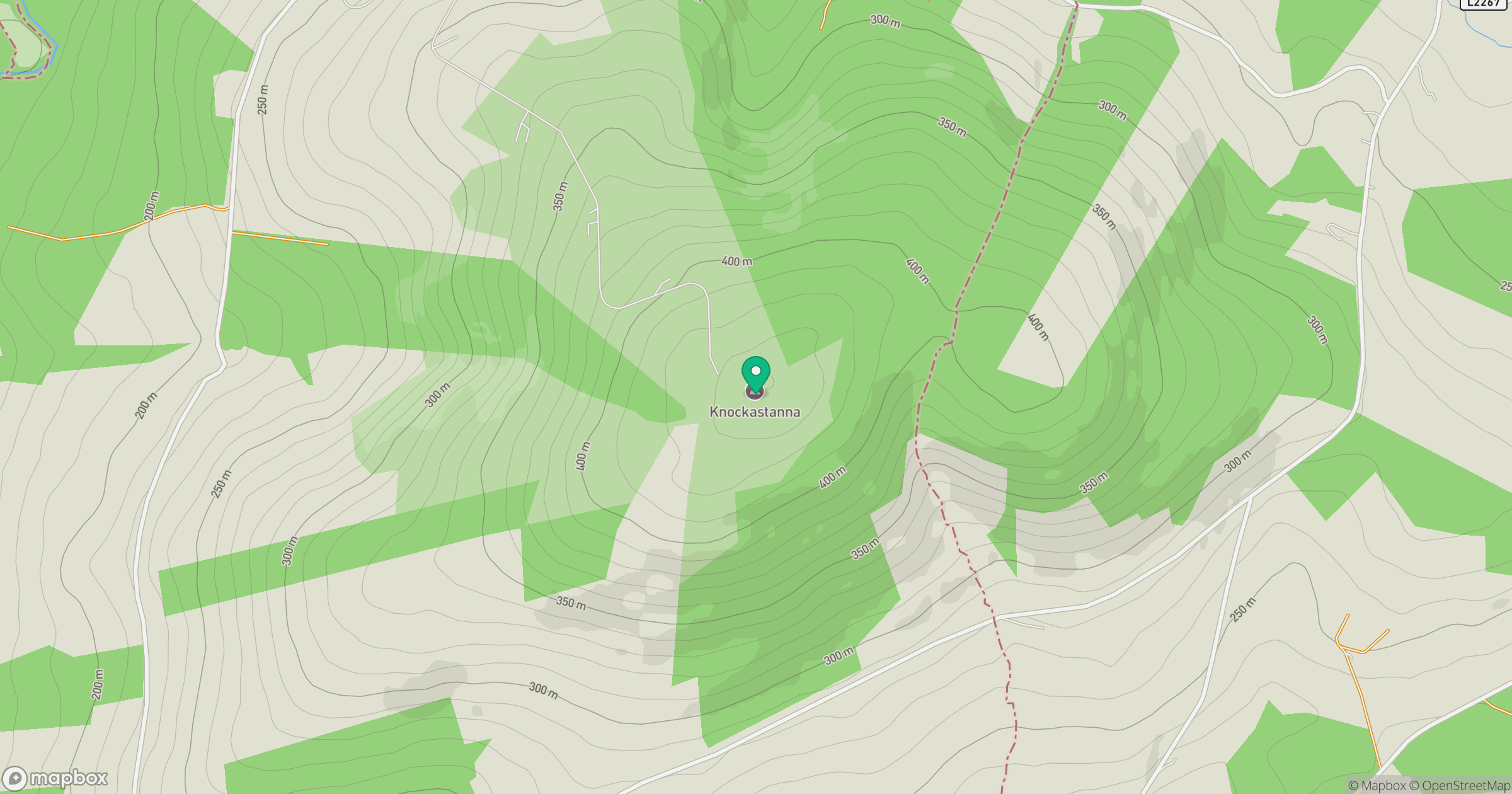
Grid reference: R863560
View on OpenStreetMapOpens a map in a new tab, centred on the hill.
Hills within 30 km
Straight-line distance, not a walking route or confirmation of access.
No comments yet. Be the first.